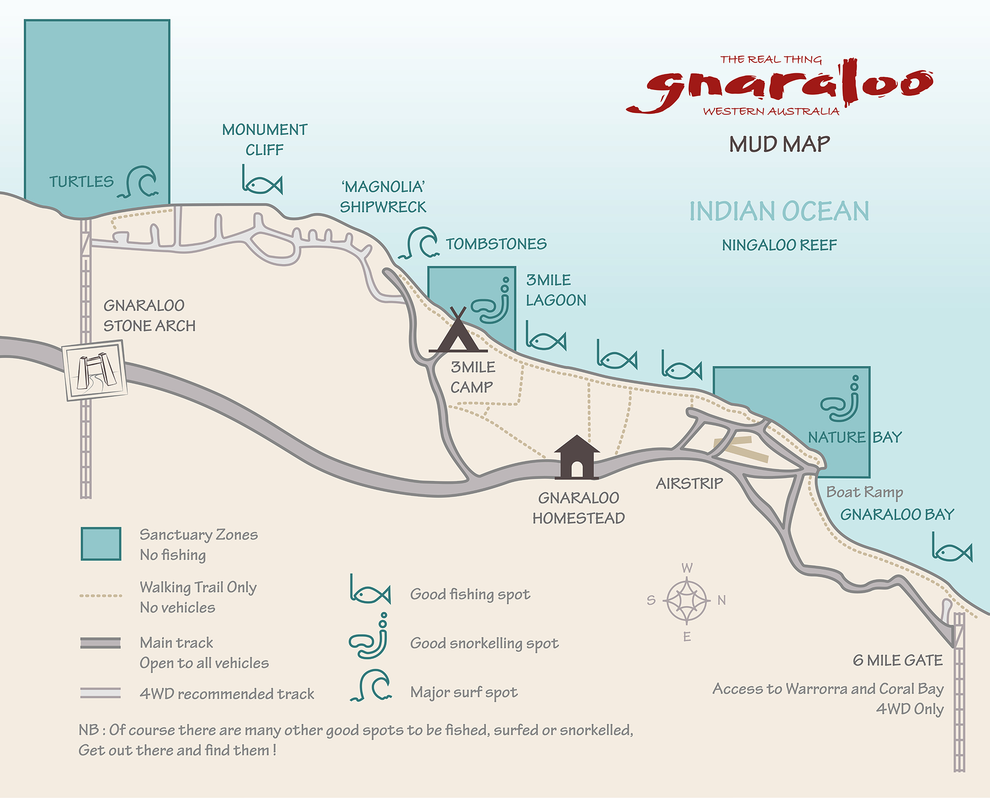
Location and Maps
Gnaraloo is 150km north of Carnarvon. From the North West Coastal Highway, take the Blowholes Road turn-off. At the ‘King Waves’ sign, turn right onto the unsealed road and travel north for 75km, passing through the Gnaraloo Stone Arch. The 3 Mile Camp turn-off is 11.5km north past the Arch. The Gnaraloo Homestead is another 4.5km north past the 3 Mile Camp turn-off.
Road conditions can vary. Please check conditions before you set off with Shire of Carnarvon (08 9941 0777) and Main Roads Department.
Remember to carry plenty of water. Gnaraloo is at the end of the road.
Use the map below to plan your itinerary:
Safe Driving Reminders
The condition of the track varies greatly, depending on weight of traffic, weather and how long it is since it was last graded (leveled). Below are tips for driving on unsealed roads:
- Take it easy! Yes, you are in the middle of nowhere, but there can be a lot of traffic on the track. Be on the lookout for animals – sheep, kangaroos, goats and cows wander in the area.
- Carry plenty of water – enough to keep all your passengers well hydrated if you have a problem and have to wait several hours (or overnight) for help.
- Make sure your vehicle is ready for the trip – is your spare tyre in good condition? Do you have a jack, wheelbrace and a few tools so you can fix minor problems?
- Fill up with fuel in Carnarvon. We hold limited stocks of fuel at the station, so you need to plan to be self sufficient. You will need enough to get to Gnaraloo, drive around while you’re here and, most importantly, get you back out again!
- If there has been recent rain in the area – check with The Shire of Carnarvon (on 9941 0000) & Main Roads Department that the roads are open before you travel.